6/5 - Day 41 - Mile 702 to 716 - 14 miles
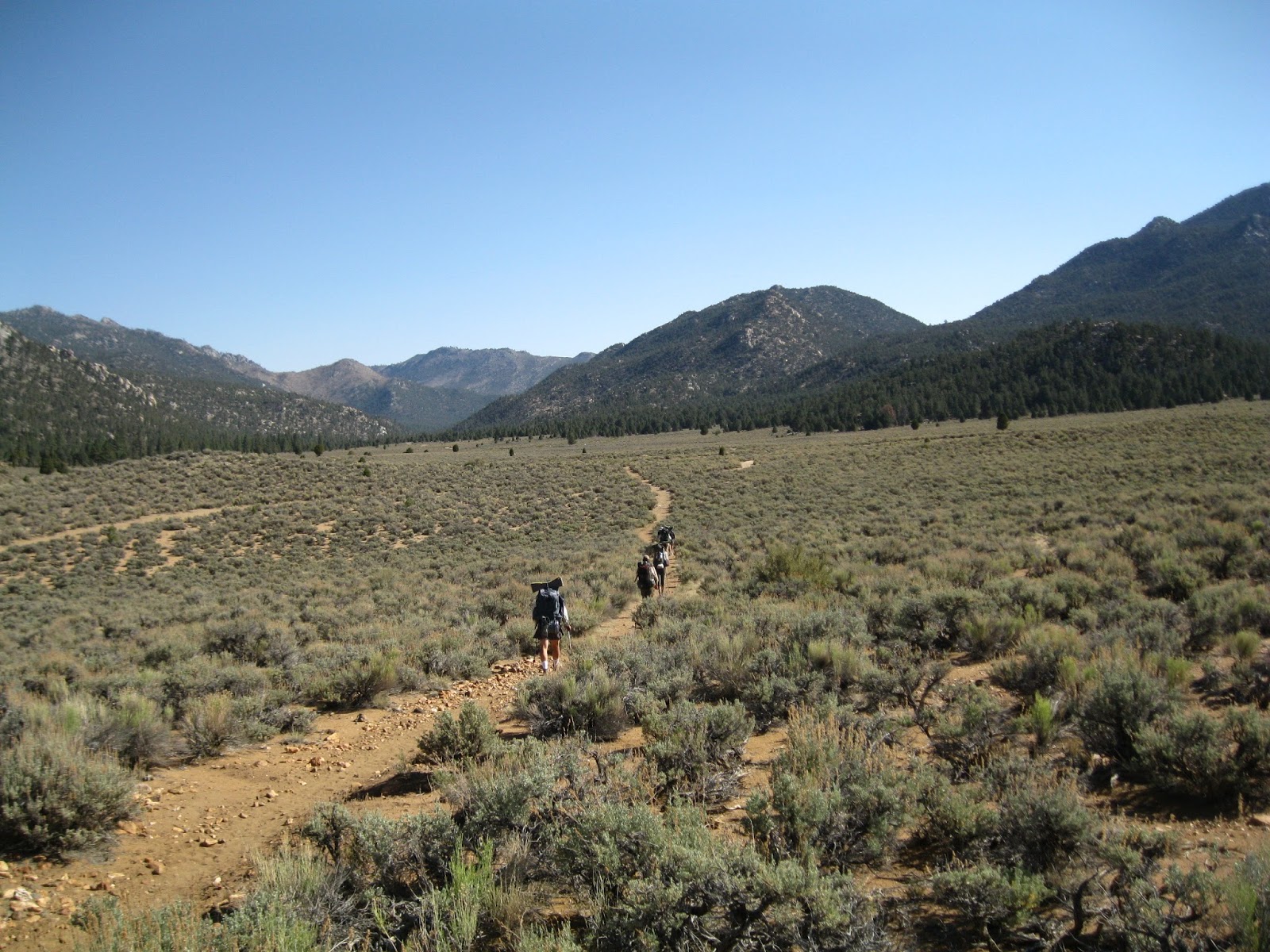
We took off from Kennedy Meadows a little later than we normally do but only planning on going 14 miles. We were planning on dropping our daily mileage down to under 20 every day due to hiking at higher elevations and harder uphill climbs. Honestly this first day wasn't too hard but we were enjoying the scenery too much to go much faster. The day started out walking out of KM on flat ground and really soft sand but after a few miles we started climbing up into the high Sierra. That first uphill climb was long but nice and gradual. We took our lunch break right before the top of that first climb. It was a nice place but nothing compared to what it looked like on the other side of that mountain. When we started descending, we found ourselves looking out into a beautiful meadow. I guess when I think of mountains, I think of steep slopes and deep valleys but what I didn't realize was that we would be encountering a whole bunch of these beautiful, flat meadows, with gorgeous flowers and flowing rivers. It was so great there that even though we had just had our lunch break, we set our bags down and enjoyed another 30 minutes, hanging out with some other hikers and looking out into the meadow. I would have loved to stay there but I knew there was only 3 more miles and one more climb till we came to another meadow - this one with a river - where we were planning on camping anyway. So on we went to the next meadow which was just as beautiful as the first.
That night there was a thunder storm a couple miles away and we got hit with a nice light shower of rain. It was a really nice "welcome to the Sierra" shower. It was just a great day and we couldn't wait for more.
6/6 - Day 42 - Mile 716 to 735 - 19 miles
Today was a very big day for us... it was the first day we would get to over 10,000 feet in elevation. I had looked at the elevation chart beforehand and had been dreading the climb a little but honestly it wasn't that bad. Yes it was hard and I had to stop to catch my breath a time or two but the Sierra Mountains are just so beautiful that I find they distract me from the physical challenges of the day. I can't say enough about how much I love hiking in the Sierra! This day again was filled with hiking up ridges that leveled out into amazing meadows. We took our lunch break at one of the most amazing water sources we had seen so far. It was just a little spring coming out of the ground a little bit off the trail. The water was clear and cold and though it was hot in the sun that day, we found a nice place in the shade to rest our feet. But all good things must come to an end so we packed up from our lunch break to start the next uphill climb - up to 10,500 feet. When we got to the end of this climb, we found an amazing spot a little bit off the trail and though it was only 5 pm, we decided to call it quits for the day and set up camp. That night the stars were amazing and bright and we slept really well.
6/7 - Day 43 - Mile 735 to 750 - 15 miles
We woke up this day to an amazing sunrise... the best one we had seen up to this point of the trip. Our original plan this day was to try to go 25 miles which would set us up for a 7 mile hike the next day before we reached the base of Mt. Whitney so that we could summit Whitney on my birthday. We were right on track to do it too but we took our lunch break at an amazing lake called Chicken Spring Lake and decided to just pack it up for the day and enjoy the lake. We had a long and hard 9 mile uphill hike to the lake (11,000 feet) and even though I was happy to rest at the lake all afternoon, MudD was feeling antsy still so he went on a little adventure by himself. The lake was backed by a mountain that went up and around to the other side... so MudD went up and hiked the whole thing. Took him about 2 hours to do it all and even though the terrain got pretty sketchy towards the end, he really enjoyed himself. The pictures he took were awesome and the views he had were amazing and beautiful.
That night we were joined by about 15 of our hiking friends who were all planning on doing the same thing we were - hike 20 miles the next day, camp 5 miles from the summit of Mt. Whitney at Guitar Lake, and summit the next morning by sunrise. So we had a great time that night, sitting there and relaxing with all these people that had turned up to join us for the night.
6/8 - Day 44 - Mile 750 to 766 - Then off the trail to Guitar Lake - 20 Miles - My birthday!
Gosh, what a great birthday this was. I can't think of another birthday that I have ever had that was even close to being like this one. It was really fun and really beautiful. The first 10 miles were fine. It was up and down and then just downhill back to 9,000 feet. We took a long snack break with a whole bunch of friends at a river because we knew we had a long and steep uphill hike ahead of us. We ate some food to sustain our energy levels for the 3 mile long stretch that would take us up 2,000 feet in elevation. Even MudD admits that it was a rough climb... perhaps the hardest of the trip so far. I was feeling strong until the last push when we started approaching 11,000 feet. This last push I had a really hard time catching my breath and boy was I feeling the elevation. But we made it to the end which was really exciting... until I realized I had left all our maps for the day and our journal at the bottom of the mountain at our snack break sight. Even though both of those things are very precious to us, it wasn't worth doing that climb again so we pressed on. In no time we had made it to the trail that we would take to summit Mt. Whitney. Whitney is not actually a part of the PCT... the PCT actually just runs by the base of the mountain. But it all in all the trip would only add 17 miles to the trip and who knows if we will ever get another chance to summit the highest mountain in the lower 48 again? Even if we did get another opportunity, we would never be in as good of shape. So we went for it. Our plan was to go a little less than 4 miles up the trail to Guitar Lake... one of the last places to camp by a water source before the summit. Again, the stars were absolutely amazing that night - we could clearly see the Milky Way - and it was just a beautiful night. It is definitely the best camping spot we had the entire trip so far and we have a feeling it will probably be in the top 5 by the time this trip is over.
6/9 - Day 45 - Guitar Lake to summit of Whitney to mile 774 - 21 miles
WOW WHAT A GREAT DAY. We woke up at 2 in the morning by Guitar Lake and started the 5 mile ascent to the top of Whitney. We wanted to get to the top in time to watch the sunrise. We left most of our stuff at Guitar Lake and just carried our packs, sleeping bags, warm clothes, some snacks, and 2 liters of water up to the top of the mountain (it was amazing to feel so light and liberated!). I'm not going to lie, even though we left most of our stuff at our base camp, that hike was hard. I think perhaps it was better that we did it in the pitch dark with just our head lamps to guide our way because if I had been able to look up and see how much farther we had to go, it may have been much harder mentally. But we had no idea where we were or how much farther we had, just that we had to walk to stay warm. The first hour wasn't too bad but the higher we went in elevation, the colder it got. We started to see some color in the sky around 4:30 and even though we knew we had an hour to go before the sun would come above the horizon, we were worried we wouldn't make it. If I thought hiking at 11,000 feet was hard, it was nothing compared to going up to 14,000 feet. We were going pretty slow but honestly I don't think I could have gone much faster. We got to the last push a little bit before 5 am and we both got a sudden burst of energy when we could see the small shack that sits on top of Mt. Whitney. It was freezing up there! We both immediately took off our wet, sweaty hiking clothes and put on our warm, dry pajamas, crawled into our sleeping bags and sat on the edge of Whitney and waited for the sun to rise. It was pretty awesome. We did that morning hike with: Hermes, Lotus, Mystique, Werewolf, Sierra Bum, Horny Toad, Mermaid, Walkie Talkie, and Happy Feet. We met our friends Unicroc, Scattracker, and Lullabye at the top... they had reached the summit the night before with all of there stuff and had camped there for the night.
We stayed up there for a little while longer but it was much too cold so we went back down. I am very happy we decided to do it at sunrise not just because it was very beautiful but also because as we went down, a ton of hikers (day hikers and through hikers) were coming up for the day. We got up before the crowds and started the day off right!
When we reached Guitar Lake again, we packed up our stuff and headed off. We were anxious to get back on the trail. It was only 9 in the morning but we had already hiked 10 miles. When we reached mile 767 we were not only back on the PCT but we had also met up with the John Muir Trail - a trail we will be following through the Sierra. Even though we were absolutely exhausted from our early morning hike, we pushed on. The next day we would be going over Forester Pass - the highest point on the PCT - and wanted to get closer so that we could do it early in the morning. Those next couple of miles were rough on us. We were pretty tired and stopped a lot for breaks and even though it was half a mile from where we were planning on camping, we found great camping at 4 pm and stopped for the day. We set up shop, cooked some food, played some cards with Unicroc and Scattracker (they killed us in euchre), and headed off to bed.
6/10 - Day 46 - Mile 774 to 788 - 14 miles
This is easily my favorite day of the hike so far. We woke up early that morning and knew that we would be climbing to 13,000 feet that day. I guess I was imagining it would be a lot like Whitney and just hard... but it was the most beautiful and fun day yet. Everything I had read about this pass scared me... I had read horror stories of people hiking through snow for 5 miles, not knowing where the trail was or which dip in the mountain the pass was and then getting to the top only to have a sketchy and scary hike down through deep, waist high snow. But I guess our year is really unusual... there was virtually no snow. So we had the trail the whole way and my oh my what amazing scenery. We would walk up to a lake, stop to take pictures and admire it only to move on and walk past an equally breathtaking lake that was actually flowing into the first one. And the hike was just plain fun! Such a good time. I really don't know what to say about it because it was just too amazing to describe. Best day ever. And one of the best parts was that when we got to the top, the beauty didn't stop! We followed a few amazing creeks and streams as we descended into a valley. We took an amazing lunch break at a small water fall and went swimming with our friend, Mermaid, who we had been hiking with for the past couple of days. Everything was going just right until MudD looked up in the sky and said, "guys we have some pretty scary looking clouds coming our way." And boy was he right. We packed up our stuff and headed on down the trail. We got another 4 miles before we started getting rained on. We had wanted to hike the rest of the 8 miles till town that day but we knew we had to go over another pass that day to get to the town... and though it wasn't at 13,000 like Forester, it was still pretty up there. We decided to set up the tent and wait out the storm. I'm happy we did because even though the rain lasted about 2 hours, we were able to find some dry wood and had a great fire that night.
6/11 - Day 47 - Mile 788 to 788.5 to Onion Valley Trailhead via Kearsarge Pass - 8 miles
So we had planned on going into the town we are in now (Bishop, CA) but to get there, we had to walk about 7.5 miles down a different trail which lead over Kearsarge pass. So that's what we did. We were all pretty low energy that day but it was gorgeous and beautiful like the rest of the week and at least we were dry. We made it to the top of the pass and ran into our old friend, Ducky, who happened be getting day hiking that day and offered to drive us the 50 miles into town... and then drive us back to the trail when we were ready. So now we are in town and its great and we can't wait to get back on the trail! But we are spending a zero here because it's a cool little town and because MudD's mom is awesome and booked us a hotel here in town as birthday presents to us. THANKS DEBRA BELL!!!!!!!! So we are relaxing and taking care of ourselves before heading out into the beautiful Sierra Mountains again!


Our swimming pool with the waterfall!


No comments:
Post a Comment